General Discussion
Related: Editorials & Other Articles, Issue Forums, Alliance Forums, Region Forums'Bomb cyclone' set to bring blizzards and hurricane-force winds to the Northeast on Friday: Here's w
'Bomb cyclone' set to bring blizzards and hurricane-force winds to the Northeast on Friday: Here's why.
By Cameron Duke published about 6 hours ago
The 'bomb cyclone' is expected to dump inches of snow
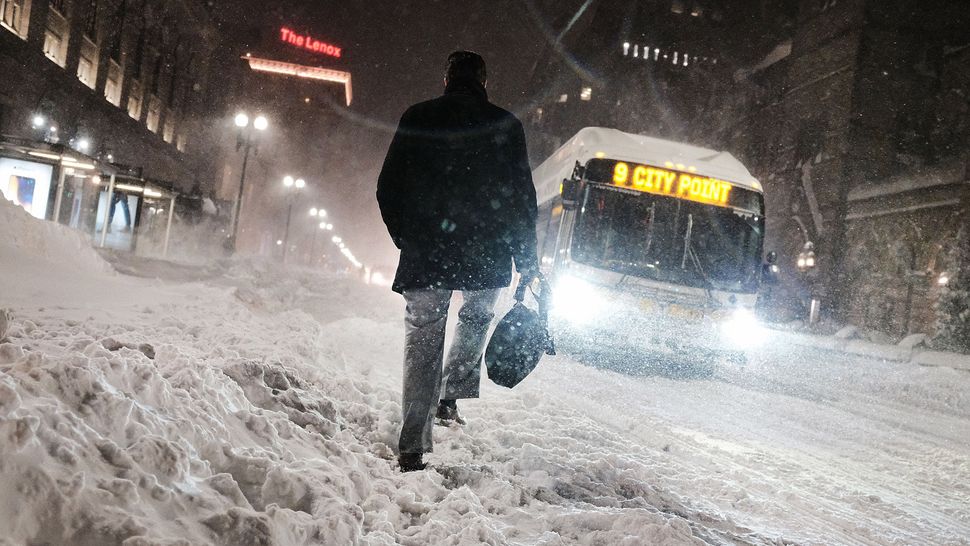
In January 2018, a bomb cyclone dumped snow across the Northeast. Here, a man walks through the streets of Boston as snow falls from the massive winter storm on Jan. 4, 2018 in Boston. (Image credit: Spencer Platt/Getty Images)
Meteorologists predict that a "bomb cyclone" will bring severe, blizzard-like conditions to much of the Northeast U.S., starting Friday night (Jan. 28). But what's behind this explosive weather and why is the storm's path so "up in the air?"
Currently, forecasts show the storm will drop at least a foot (30 centimeters) of snow in cities along the New England coast, along with minor flooding and hurricane-force wind gusts, according to a report from Weather.com. When all is said and done, the storm will likely impact the New England coast from Maine down to Virginia, with the bulk of the storm hitting Rhode Island and Massachusetts Friday night. "The models continue to show a nor'easter with blockbuster potential for the weekend, mainly late Friday through Saturday," meteorologist Brian Miller said in a report for CNN.
Nor'easters like this one are extratropical cyclones that begin as low-pressure systems over the northern Atlantic ocean, according to the U.S. National Weather Service (NWS). They can occur at any time of year but they typically strike during the wintry months, between November and March.
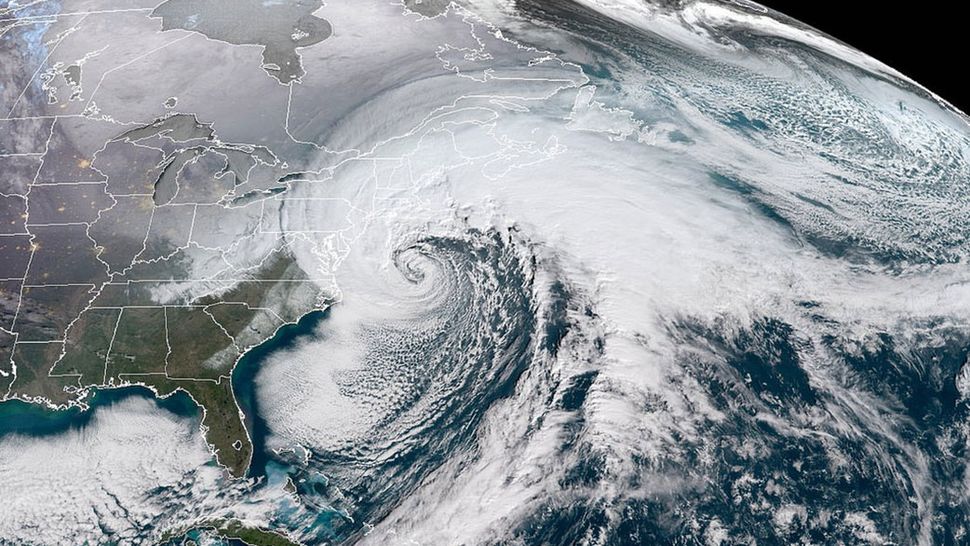
The National Oceanic and Atmospheric Administration (NOAA) GOES-16 satellite caught a dramatic view of the bomb cyclone moving up the East Coast on Jan. 4, 2017. This is NOT an image of the current nor'easter. (Image credit: NOAA/CIRA)
They are referred to as nor'easters because their strongest winds over the mid-Atlantic coast tend to originate from the northeast. The storms are formed when the warm, northbound Gulf Stream current in the Atlantic Ocean interacts with the polar jet stream above it that's carrying Arctic air down from Canada. And here's where the "bomb cyclone" part of this weather comes in: When the frigid jet stream collides with air warmed by the Gulf Stream, the difference in temperature creates a low-pressure system that can spiral into a cyclone. The disparity in temperature not only energizes the storm but also creates massive amounts of wet, heavy snow.
More:
https://www.livescience.com/bomb-cyclone-blizzards-northeast?utm_source=notification
 = new reply since forum marked as read
Highlight:
NoneDon't highlight anything
5 newestHighlight 5 most recent replies
= new reply since forum marked as read
Highlight:
NoneDon't highlight anything
5 newestHighlight 5 most recent replies

Cha
(296,878 posts)Care Northeast Peeps!


NutmegYankee
(16,199 posts)I’ve had some good storms in the past, including a 30” snowfall in February 2013. I’ve had three with totals in the 20” range. Too many to count have dropped 10-15”.
Some high winds expected but with cold air conditions the snow should be fluffy and not stick to everything.
Cha
(296,878 posts)Teacher of how to prepare yourself!
Best of Luck to everybody!
I grew up in Colorado and lived in Upper State New York by the Adirondacks for 12 years.. Brrr!
