Thousands urged to flee ahead of post-Florence flooding in South Carolina
Source: Reuters
SEPTEMBER 23, 2018 / 2:44 AM / UPDATED 5 HOURS AGO
Harriet McLeod, Gene Cherry
4 MIN READ
(Reuters) - As many as 8,000 people in and around the city of Georgetown, South Carolina, have been urged to evacuate ahead severe flooding expected this week from two rain-gorged rivers in what may be the final destructive chapter of Hurricane Florence.
Floodwaters of 5 to 10 feet (1.5 to 3 m) are expected to inundate Georgetown and surrounding communities by late this week as the Pee Dee and Waccamaw rivers overurn their banks along the low-lying tidal flats where they converge at Winyah Bay, which flows into the Atlantic.
Emergency management officials began sending pre-recorded telephone messages to residents in harm’s way over the weekend, and will probably start going door-to-door in the next few days, Georgetown County spokeswoman Jackie Broach-Akers said.
The potential flood zone encompasses some 3,500 homes in Georgetown, which lies at the confluence of the two rivers at the top of the bay, and the coastal resort community of Pawleys Island, she told Reuters.
Read more: https://www.reuters.com/article/us-storm-florence/thousands-urged-to-flee-ahead-of-post-florence-flooding-in-south-carolina-idUSKCN1M305N
 = new reply since forum marked as read
Highlight:
NoneDon't highlight anything
5 newestHighlight 5 most recent replies
= new reply since forum marked as read
Highlight:
NoneDon't highlight anything
5 newestHighlight 5 most recent replies

BumRushDaShow
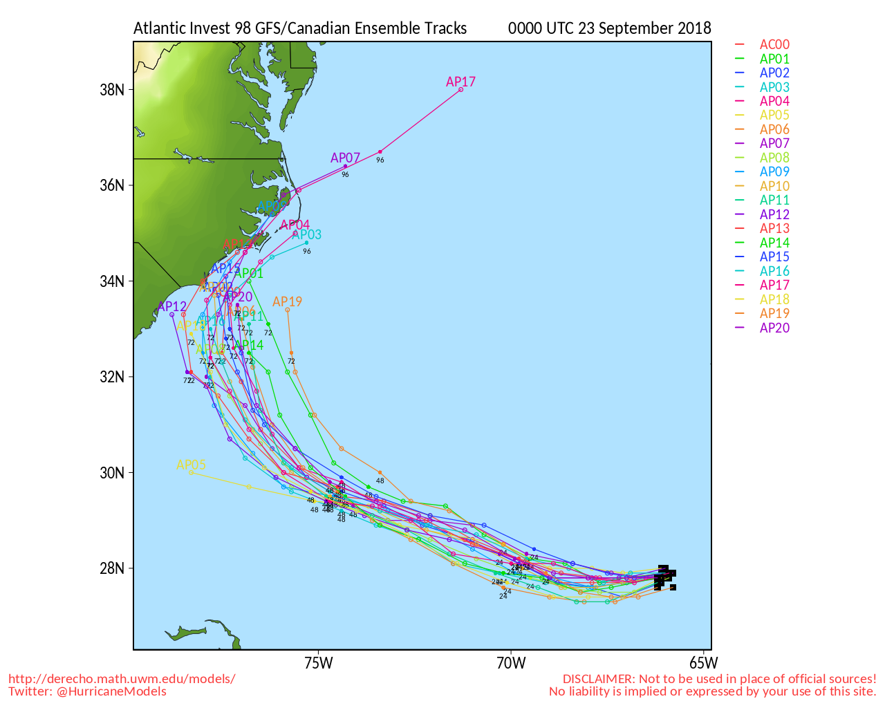
(128,839 posts)STILL may not be the "final destructive chapter" because there is a remnant of Florence that has looped around in the Atlantic and may give a glancing blow to the east coast with more rain.
Link to tweet
TEXT
Here's #Florence, the whirling dervish of 2018, from hurricane to remnant swirl.
This storm is poised to skirt coastal North Carolina (for a 2nd time) on Tuesday with rain ... National Hurricane Center gives it a 30% chance of regenerating 🚫
6:53 AM - Sep 23, 2018

KY_EnviroGuy
(14,489 posts)Waccamaw, Sampit, Black and Greater Pee Dee rivers all pour into the Winyah Bay at Georgetown. The Waccamaw and Pee Dee is receiving hurricane water from upstate SC and a significant portion of North Carolina. The downtown area was severely damaged by flooding years ago (I believe in the 90s) but slowly rebuilt. I lived there for a while on the Winyah Bay and they call this the Low Country for good reason.
These people love the water and every driveway has a boat, but there's a lot of very poor people there that don't need this misery. Many homes, some industries and a lot of small businesses will probably be damaged.
Here's a good source for local news: https://www.southstrandnews.com/
(snip)
BumRushDaShow
(128,839 posts)just brought up a thought here that would also be impacted -

http://ldhi.library.cofc.edu/exhibits/show/africanpassageslowcountryadapt/sectionii_introduction/rice_lowcountry
The famous "Carolina Gold" (which I have bought) is grown in Darlington, SC much further inland after the devastation of previous hurricanes.
KY_EnviroGuy
(14,489 posts)Rice is no longer grown there in any quantity but there are remnants of the old plantations and a few plantations have been preserved for tourists. There's not a lot of agriculture in the low country because the soil is so sandy. Maybe some corn and tobacco, but the primary crop is pine trees for the paper mills. When I stayed there, Georgetown Steel mill, International Paper mill, and the Santee Cooper power plant were the big employers, along with tourism, commercial and sport fishing.
Darn good fishing and shrimping all around, though. This 'ole TN/KY hillbilly actually learned how to throw a cast net and fish for spot-tail bass in the bay and gather oysters, too! Those were some good times.
.........
BumRushDaShow
(128,839 posts)and basically, due to so much loss of coastline from hurricane inundation (and of course rising sea levels), that pretty much ended the crop along and just inland from there. But was is still surprising to me is that when I was tracking Florence last week via some storm chasers down there, I was surprised at all the pine trees everywhere, along with their debris during and after the storm.
Someone either here or on my weather forum had posted something like "After a storm blows through here, all that's left is 'the smell of pine'".
I know this is partly why there is a thriving furniture industry in the Carolinas but I guess nowadays it doesn't get as much press as the Pacific Northwest and their logging.
KY_EnviroGuy
(14,489 posts)those pines are entirely used for pulp mills and the lumber is worthless for construction. They're very tall, skinny trees with lots of knots! So, if a tract of timber is wiped out by hurricane, the mills just send it all to the monster chippers and huge chip piles.
Much of the land there has a constant cover of pine needles and cones laying all over, and is very sandy. Hard to grow grass there.
Paper companies like IP, Weyerhaeuser and Meade own vast tracts of land in the low country, much of which has the underbrush burned off every few years - creating quite another stink to go along with that of the mills. Log trucks were a common site in Georgetown and it was quite a rough town in the late 70s, with a steel mill and paper mill square in the middle of town.
Like my original native Tennessee, the furniture industry in NC I believe is more in the mountains where hardwoods are prevalent, which would not have been affected by hurricanes very much (more likely tornadoes). Name not being entirely coincidental, the town of Hickory is one of the old furniture and wood product centers in NC.
Thanks again for the cool map!.......
BumRushDaShow
(128,839 posts)
Right next door to me in New Jersey are the famous "Pine Barrens", an area which also sandy soil (and was the subject of an infamous Soprano's episode
 )!
)!
kiri
(794 posts)40 yrs ago, turpentine was a major product, made from "distilling" Carolina pine trees.
Turpentine usage has declined in favor of petroleum-based products.
Turpentine is a nature-based solvent, paint thinner for oil-based paints, hand cleaner, with a characteristic odor. Used to treat wood gutters every year to prevent rot.
BumRushDaShow
(128,839 posts)They still do make it. One of my sisters has a longleaf pine believe it or not. It's one of the pines that was used to make turpentine. And it's all the way up here in PA just outside of Philly! A Florida native tree. Climate change!
That pine is fascinating though because during the first 7 years of its life, it remains in what is dubbed its "grass stage" and looks like a big tuft of grass. Then it shoots up a trunk as it matures and grows tall and thin (which helps it deal with the winter wildfires).
I grew up with 2 white pines in my backyard. The oldest one eventually grew to be 80ft tall and had to finally be removed. The younger one had been planted too close to the house and had been removed years before.

nitpicker
(7,153 posts)(snip)
1. A broad area of low pressure located about 300 miles south of Cape
Hatteras, North Carolina, continues to produce showers and
thunderstorms on its north side. Satellite data indicate that the
circulation of the low is elongated and not well organized.
However, this system could still become a tropical depression later
today while it moves northwestward. By tonight and Wednesday,
additional development appears unlikely, due to strong upper-level
winds, while the system moves northward and north-northeastward near
the southeastern United States coast. Regardless of tropical cyclone
formation, this system will likely enhance rainfall across portions
of northeastern South Carolina and eastern North Carolina later
today and tonight. In addition, dangerous surf conditions and rip
currents are expected along portions of the North Carolina coast
today. For more information, please see products from your local
National Weather Service office.
* Formation chance through 48 hours...medium...50 percent.
* Formation chance through 5 days...medium...50 percent.
(snip)