From phys.org
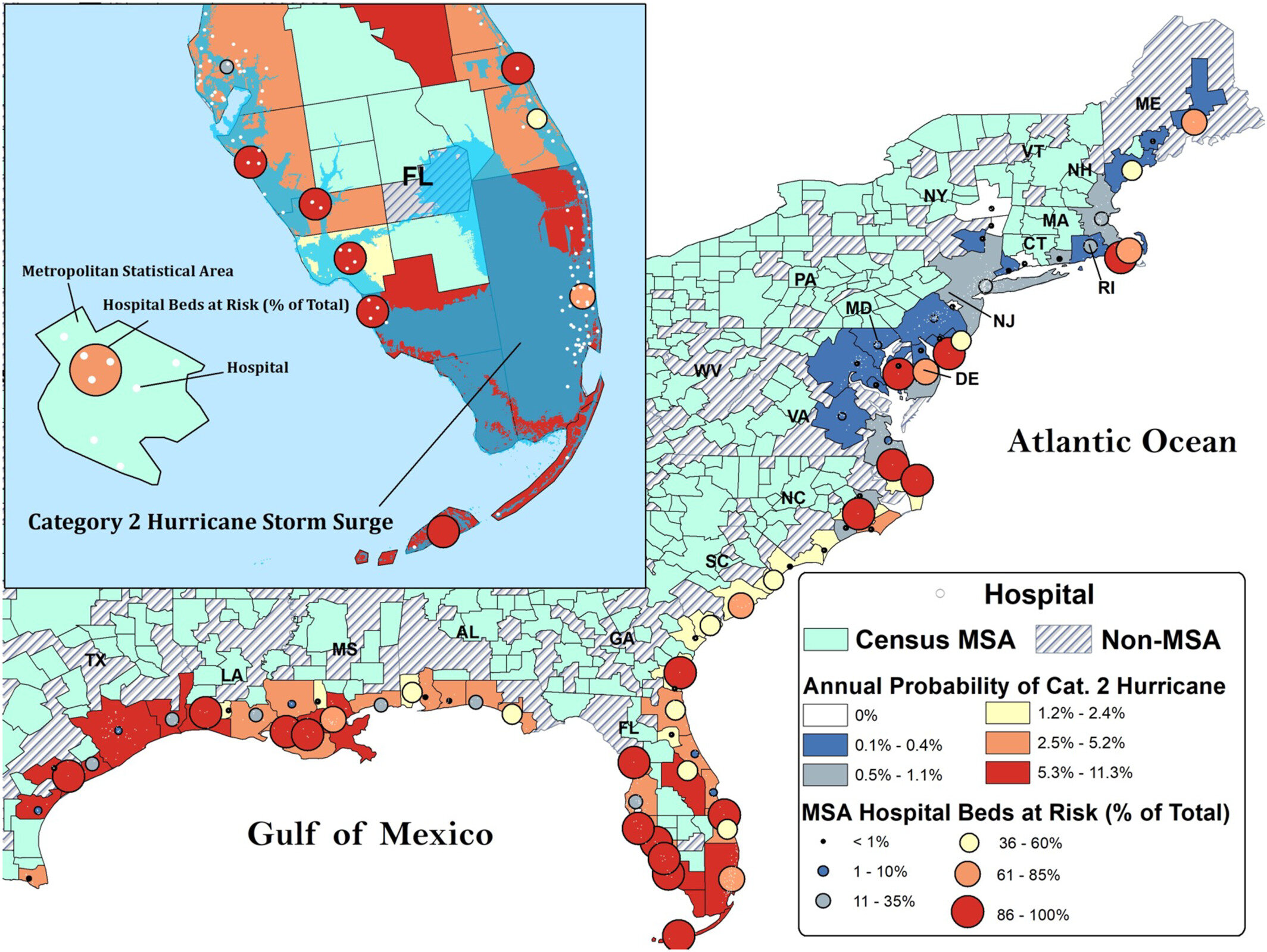
Annual predicted probability of storm landfall and percentage of beds at risk. Map of metropolitan statistical areas (MSAs) on the United States Atlantic and Gulf Coasts at risk of hurricane landfall. Shading indicates probability of landfall. Circles represent percent of beds at risk from a category 2 hurricane. Inset depicts focused area of Florida peninsula with hospital locations (white markers) and Sea, Lake and Overland Surges from Hurricane model predicted flooding area in blue. Credit: GeoHealth (2022). DOI: 10.1029/2022GH000651
__________________________________________________________________________________________________
...
The 10 metro areas where a Category 2 hurricane threatens access to hospital care most are:
- Miami-Fort Lauderdale-West Palm Beach, FL
- New York-Newark-Jersey City, NY-NJ-PA
- Boston-Cambridge-Newton, MA-NH
- Orlando-Kissimmee-Sanford, FL
- New Orleans-Metairie, LA
- Tampa-St. Petersburg-Clearwater, FL
- North Port-Sarasota-Bradenton, FL
- Jacksonville, FL
- Cape Coral-Fort Myers, FL
- Philadelphia-Camden-Wilmington, PA-NJ-DE-MD
...
 = new reply since forum marked as read
