Scientists discover huge fossil lake under Greenland
The lake bed could be millions of years old, formed at a time when Greenland was still green.
by Mihai Andrei November 12, 2020
Greenland’s relief is every bit as varied and spectacular as any place on Earth, but we can’t really see it because of all the ice. But if you could peer beneath this ice (say, with satellite radar data), you could see some of this ice-hidden relief. This is exactly how researchers discovered what they believe to be an ancient, ‘fossil’ lake. They think it’s as big as the states of Delaware and Rhode Island combined, or about a third of Wales.
Researchers routinely use satellite data to analyze Greenland. They’re not usually looking for submerged geography, but they’re looking to see how much the ice sheet is thinning. In order to do this, they use airborne geophysical instruments that send radar signals — signals which can penetrate ice but bounce off from the underlying solid surface.
So with this approach, they can catch a glimpse of the geological structure beneath the ice.
“This could be an important repository of information, in a landscape that right now is totally concealed and inaccessible,” said Guy Paxman, a postdocste at Columbia University’s Lamont-Doherty Earth Observatory and lead author of the report. “We’re working to try and understand how the Greenland ice sheet has behaved in the past. It’s important if we want to understand how it will behave in future decades.”
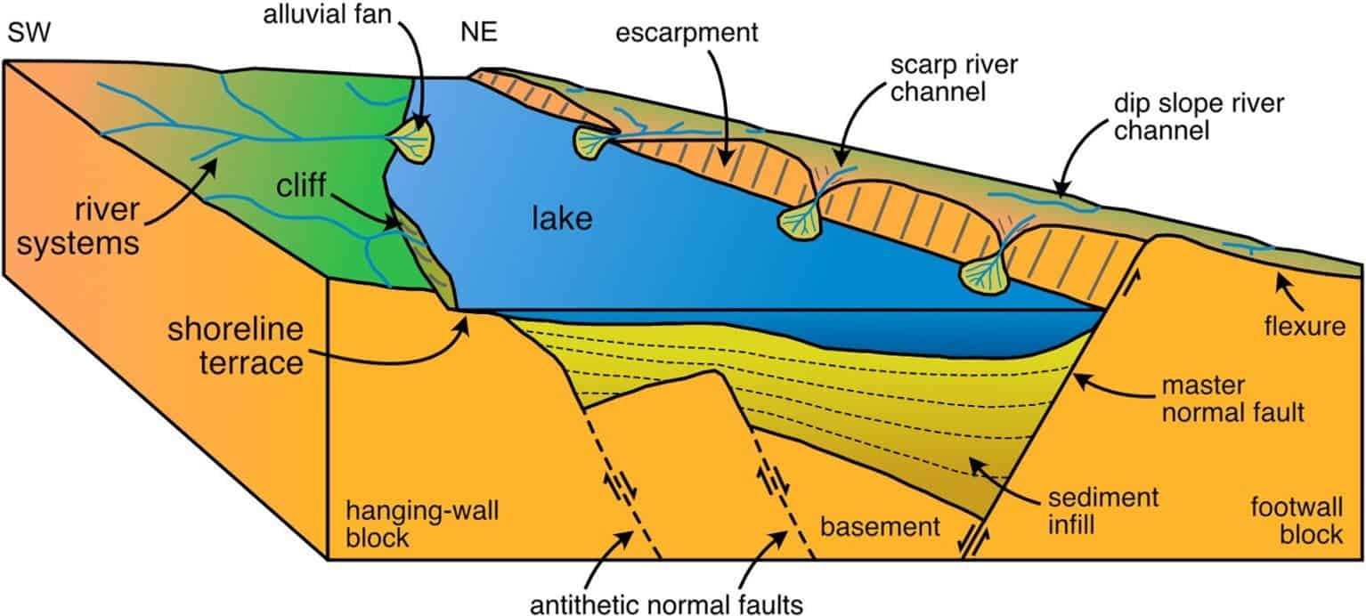
A depiction of the ancient lake and its geologic surroundings. Credits: Paxman et al.
More:
https://www.zmescience.com/science/news-science/greenland-lake-river-12112020/
 = new reply since forum marked as read
